New maps released by conservation lobby group Forest & Bird have intensified debate over the Government's proposed Conservation Amendment Bill, with critics warning that significant areas of New Zealand's public conservation estate could become easier to sell, exchange or open to expanded economic activity.
By eLocal Report
The legislation, which passed its first reading in Parliament last month, is being promoted by the Government as a modernisation of conservation management. However, environmental groups, recreational users and some outdoor organisations argue the reforms could fundamentally alter how public conservation land is protected and managed.
What Would Change?
According to the Government, the bill is intended to simplify management of the conservation estate, create new funding mechanisms for the Department of Conservation (DOC), and provide clearer processes for land exchanges and disposals.
National parks, wilderness areas, ecological reserves, scientific reserves, marine reserves and several other protected categories would remain exempt from sale.
However, Forest & Bird says large areas of other conservation land could potentially become eligible for exchange or disposal under the proposed framework.
Forest & Bird Raises Alarm
Forest & Bird has produced a series of regional maps highlighting areas it believes could be affected by the reforms.
The organisation says some of New Zealand's most popular recreational and natural areas could potentially fall within the new framework, including parts of:
- Tararua Forest Park
- Kaimanawa Forest Park
- Sections of Te Wāhipounamu World Heritage Area
- Various conservation reserves acquired through public fundraising and donations
Richard Capie, Forest & Bird's Chief Advisor on Conservation Policy, said the maps help New Zealanders understand the scale of the proposed changes.
"I think New Zealanders will be furious and will let their voices be heard in no uncertain terms that they do not want that to happen," Capie told RNZ.
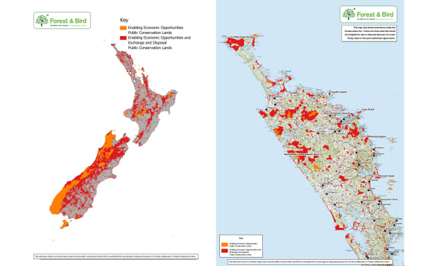
Forest & Bird map showing areas it believes could be affected by the proposed reforms. Photo: RNZ / Supplied
Tourism Industry Supports Elements of Reform
Not all groups oppose the proposed changes.
Tourism Industry Aotearoa has welcomed aspects of the bill, arguing that conservation and tourism can work more effectively together.
The Government is also proposing new visitor levies and charges that Conservation Minister Tama Potaka says could raise approximately $60 million annually for DOC. Revenue from any future land sales would also flow into conservation funding.
Potaka has argued that maintaining visitor infrastructure, tracks and biodiversity programmes requires sustainable long-term funding.
Hunters and Outdoor Recreation Groups Concerned
Several outdoor recreation organisations have expressed concern about the bill.
The New Zealand Deerstalkers Association fears public access to hunting and recreational areas could be compromised if conservation land is exchanged or sold.
National President Callum Sheridan warned that access easements could potentially be affected.
"All of a sudden you could be turning up on a Sunday to do your local bush walk and you're unable to do it because of the access or because the land has been sold," Sheridan said.
The Federated Mountain Clubs have also criticised the legislation, arguing that it places insufficient weight on recreational use when considering future land transactions.
Government Pushes Back
Conservation Minister Tama Potaka has rejected claims that the Government is preparing a large-scale sell-off of conservation land.
In a statement provided to RNZ, Potaka said:
"The Department of Conservation is not embarking on a programme of selling conservation land, nor does the Bill direct or require any land to be sold."
He said the reforms are intended to provide clearer legal processes while ensuring conservation values remain central to decision-making.
According to Potaka, any future land exchanges or disposals would still require consideration of:
- Conservation values
- Recreation values
- Public access
- Māori rights and interests
He also noted that legal protections such as covenants and easements could be used to preserve access and conservation outcomes even if ownership changes.
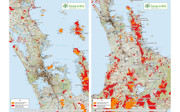
Forest & Bird map showing potentially affected areas in Auckland, Waikato and Coromandel. Photo: RNZ / Supplied
Why This Matters
The debate highlights a broader question facing New Zealand: how to fund conservation while protecting public ownership, biodiversity and recreational access.
Supporters of the bill argue DOC requires greater flexibility and sustainable funding sources to manage an extensive conservation estate.
Critics fear the proposed framework could gradually weaken protections for public land and create future pressure for commercial development or disposal of areas currently considered part of New Zealand's natural heritage.
Public submissions on the Conservation Amendment Bill remain open until 2 July.
The Road Ahead
With conservation groups, tourism operators, hunters, trampers and outdoor recreation organisations all weighing in, the bill is shaping up to be one of the most closely watched environmental debates of the year.
Whether the legislation ultimately delivers better conservation outcomes or creates new risks for public land will likely become a central issue as the Select Committee process unfolds.
Forest & Bird's Maps
National Overview
Forest & Bird produced maps of what it says are the areas where conservation land could be sold. Photo: RNZ / Supplied
Auckland & Waikato
Auckland and Waikato areas Forest & Bird says are marked out for economic activity and potential exchange or disposal provisions. Photo: RNZ / Supplied
Bay of Plenty & Coromandel
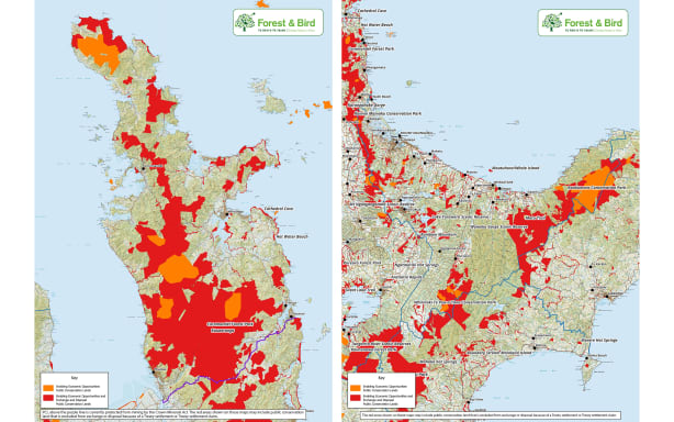
Bay of Plenty and Coromandel areas identified by Forest & Bird. Photo: RNZ / Supplied
Hawke's Bay & Gisborne
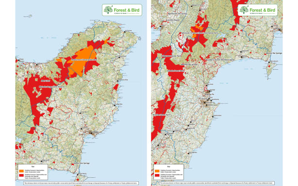
Hawke's Bay and Gisborne areas identified by Forest & Bird. Photo: RNZ / Supplied
Taranaki, Manawatū & Whanganui
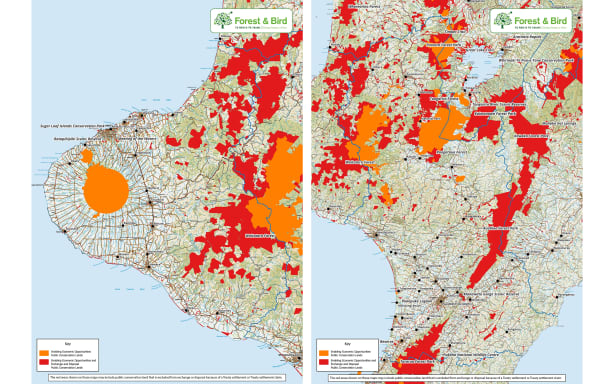
Taranaki, Manawatū and Whanganui areas identified by Forest & Bird. Photo: RNZ / Supplied
Wellington, Nelson & Tasman
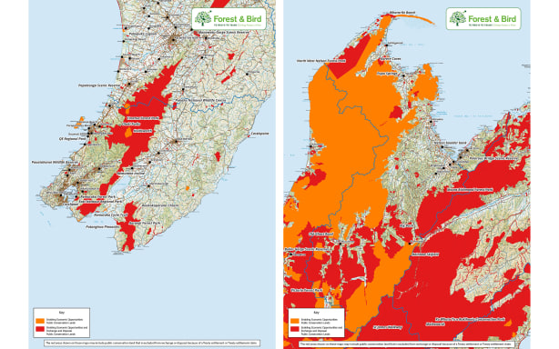
Wellington, Nelson and Tasman areas identified by Forest & Bird. Photo: RNZ / Supplied
Marlborough & West Coast
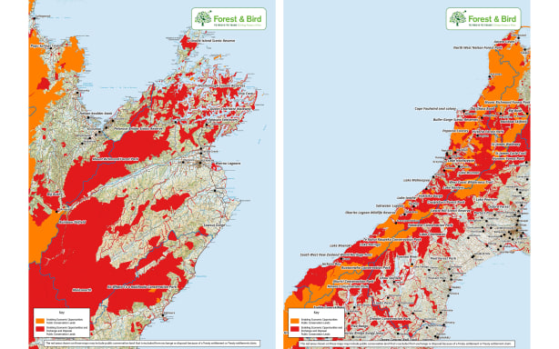
Marlborough and West Coast areas identified by Forest & Bird. Photo: RNZ / Supplied
Canterbury & Otago
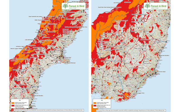
Canterbury and Otago areas identified by Forest & Bird. Photo: RNZ / Supplied
Southland & Chatham Islands
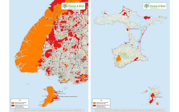
Southland and Chatham Islands areas identified by Forest & Bird. Photo: RNZ / Supplied
Source:** RNZ | Farah Hancock | 19 June 2026